16 Jul Surveying to Industry Standard AS5488
Surveying to Industry Standard ‘AS5488-Classification of Subsurface Utility Information’
JFP Survey, provides reliable underground service locations for your design/construction requirements at a reasonable cost. A lack of experience and/or poor planning will significantly inflate this cost, particularly if aiming for precise location. Although, without this information or misinterpreted locations can cause signification costs in redesign or damages to this infrastructure. JFP have recently enhanced our procedures to reduce the possibility of our data being misinterpreted by your project team. We have now introduced the Industry standard ‘AS5488-Classification of Subsurface Utility Information’ (SUI) to our survey procedures.
SUI surveys are often a combination of various methods with varying accuracy. These include plotting off records and combining this with locations from visible evidence, as well as working with Underground Service Locators utilising Electronic tracing; Ground Penetrating Radar and/or Vacuum Excavation. The SUI Standard ensures this information can be presented with the level of location accuracy clearly identified. (See the below sketch showing SUI locations by remote detection). Quality level information is grouped as follows:
- QUALITY LEVEL A: Highest quality level, positive identification and absolute spatial positioning in three dimensions (eg Pot-holing; Direct measurements);
- QUALITY LEVEL B: Relative subsurface feature location in three dimensions (eg Electronic trace);
- QUALITY LEVEL C: Approximate location using a combination of existing records and accurate survey of visible evidence;
- QUALITY LEVEL D: Lowest quality level. Compiled from existing records, site inspections, anecdotal evidence.
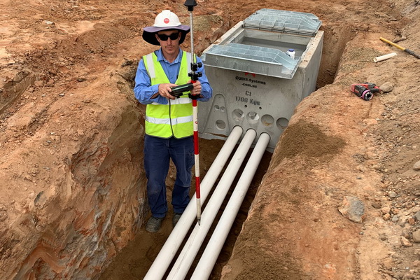
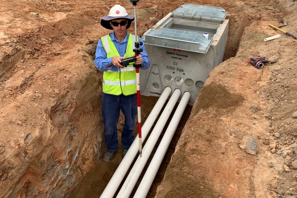
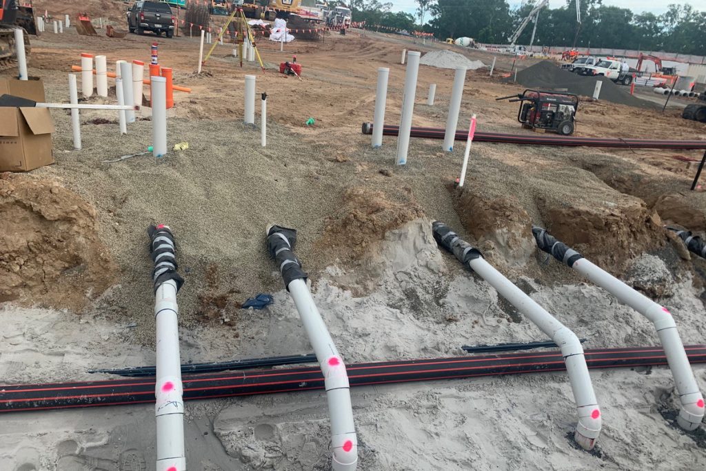
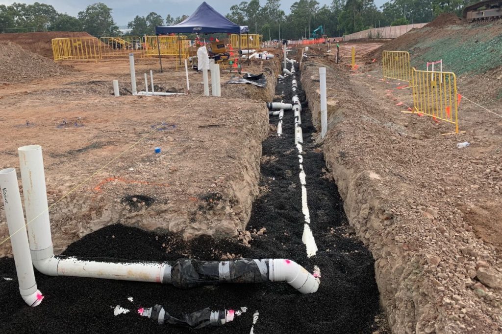
When aiming for QL-A, 3 dimensional location accuracy can only be achieved by direct measurements. One of the methods to achieve this is by measuring inside of manholes to obtain pipe invert levels. These IL’s are connected from manhole to manhole as long as the pipe is a gravity main built at a consistent grade. All other SUI requires extensive Vacuum excavation (Pot-holing) to create an underground 3 dimensional model. The cost to complete this type of modelling is not feasible for the whole site. The most efficient way is to begin the process with initial surveys that locate contours and features. Visible located evidence of SUI are compared to Dial Before You Dig (DBYD) and Local Council As constructed records to produce an approximate map of underground services (QL-C). Detailed design can commence from this point. Clash detection of proposed services and excavation with existing SUI is scrutinised with 12d software. So it’s prudent the accuracy requirement begins low until areas of concern are mapped out by the design team for further investigation where higher accuracy is important.
It’s important to understand the costs associated with locating at the various quality levels. JFP, with decades of experience, always aim to find the right balance between costs and location accuracy requirements. No one wants to see money go down the drain!
Sorry, the comment form is closed at this time.